Lightning causes damage in Washington but severe weather notably absent
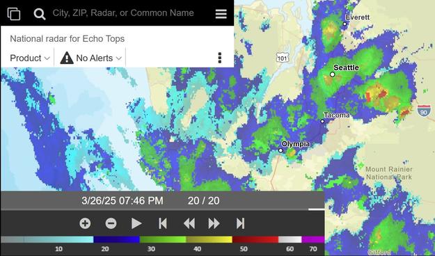
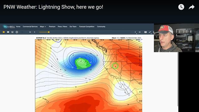
Thunderstorms were observed throughout the Pacific Northwest on Wednesday as warm, moist air was brought into the region ahead of an incoming cold front and low pressure system. Night owls in Eastern Washington were treated to both lightning and the northern lights with beautiful videos captured in Connell and Moses Lake.
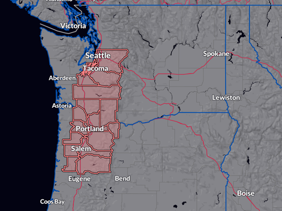
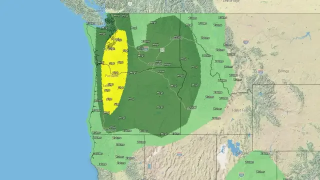
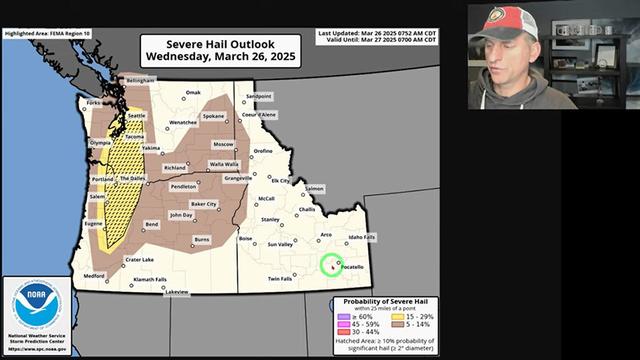
There was a risk of severe thunderstorms, including large hail, damaging wind, and an isolated tornado. Despite a severe thunderstorm watch being issued, those conditions did not materialize anywhere in the region.
Ingalls Weather thanks the support it gets from donors. Please consider making a small donation at this link to help me pay for the website and access to premium weather data.
Lightning damage
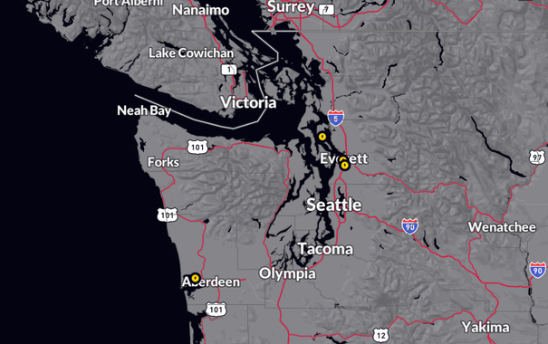
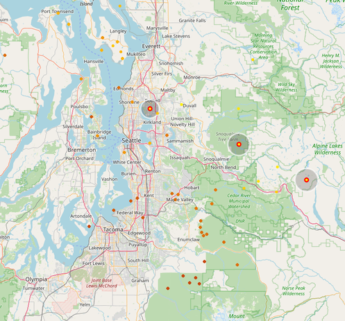
Lightning damage reports received by the NWS. (RadarOmega)The thunderstorms were particularly active in Washington where lightning strikes damaged homes and infrastructure. No injuries have been reported. Between Aberdeen and Ocean Shores, Grays Harbor PUD reported damage to some of their equipment around 17:20.
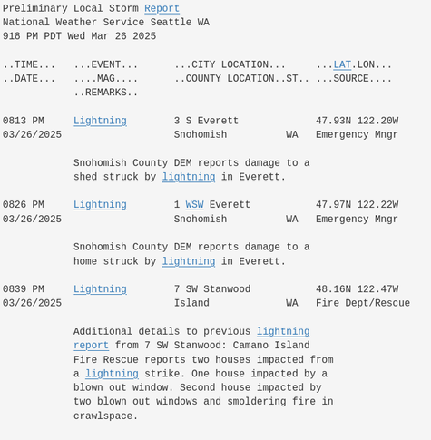
The storms approached Everett later in the evening where a shed was damaged and a house caught on fire in separate events. On Camano Island the National Weather Service received a report of a lightning striking a home, setting it on fire. The same strike also blew out two windows in that home and another window in a home nearby.
Severe weather forecast bust?
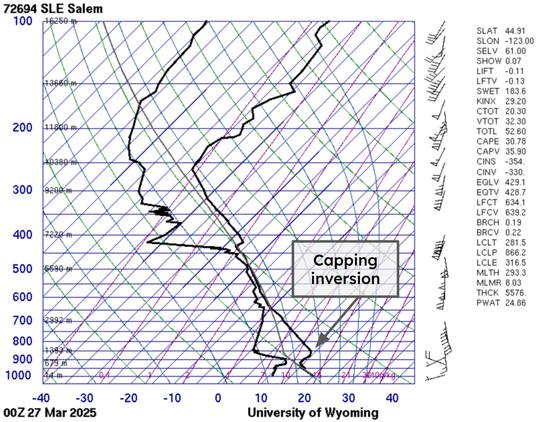
Data from the 17:00 PT Wednesday weather balloon at Salem, Oregon. (Univ. of Wyoming)The conditions were in place to produce a few very large thunderstorms in the Pacific Northwest on Wednesday, but these storms never materialized. For the Portland metro, weather was even more mellow than Seattle with just a few lightning strikes and generally light showers.
Thunderstorm development was impeded by a few issues. Surface moisture west of the Cascades was not as impressive as model guidance had shown in the lead up to the event. As such, there was less water to move upward to form larger thunderstorms.
This could have been overcome, however, if the capping inversion had been burst. Very warm temperatures were present in a layer above the surface due to the mid-level wind conditions. Cloud cover and influence from the Pacific Ocean kept the ground in Western Oregon from heating up enough to overcome the cap.
Showers did develop in Western Oregon but these were generally high-based instability. The region above the cap was drier than the surface, so there was less moisture to lift above the cap and the showers were quite a bit weaker than what was possible.
This had a cascading effect for the remainder of the day. The primary risk was that if the capping inversion broke, the moisture from the surface would surge upward rapidly and generate the kind of thunderstorms that can produce large hail and tornadoes.
Instead, by the time the storms started firing well in Southwest Washington daytime heating was already being lost and they didn’t have the momentum they could have had had storm development initiated somewhere closer to Salem or Eugene. As we saw last night, run of the mill thunderstorms can still cause damage but the threat is far less acute.
A capping inversion is a common theme in severe weather outbreaks in the Southern Plains. There, warm air from the high-altitude mountains of Northern Mexico is blown over Texas, Oklahoma, and Kansas from time to time.
The presence of a cap can actually amplify a severe weather threat. Without a cap, storms can fire too early and fizzle out. With a cap the energy below the inversion amplifies to sometimes extreme levels before there’s enough upward motion to blast through and initiate rapid storm development.
Severe weather forecasts involving a capping inversion are very difficult because on the one hand, a strong cap is hard to overcome even under otherwise ideal circumstances. On the other hand, if the cap is broken intense and damaging thunderstorms can flare up quite rapidly. Messaging such a scenario to the public can be as difficult as messaging a near-freezing possible snow event for Portland or Seattle.
A derailed hype train
Without naming names, it is important to acknowledge the role social media hype played in perceptions of this forecast bust. Responsible meteorologists and weather nerds throughout the region did what I felt was a decent job at conveying the risk of this setup while avoiding the hype.
It is inevitable that there will be some form of a hype train in these events. People naturally grasp onto the worst possible scenario, which in this case was tennis ball size hail and tornadoes.
That said, the hype was worsened by some social media pages who either are run by excited weather nerds themselves or to generate web traffic. Terms such as “GORILLA HAIL” were applied when the risk for large hail was always quite low. One problematic page even took it upon themselves to issue their own tornado watch leading to hundreds of shares on Facebook.
Well-meaning excited meteorologists and weather nerds can use this as a teaching moment on the importance of messaging and severe weather risk. I don’t fault weather nerds for being excited by a truly unique severe weather setup in an unusual part of the world. Heck, I may or may not have been one of those with my Facebook weather page in high school.
I am a firm believer in the value of having an aspiring meteorologist posting public-facing weather content on social media. This experience in dealing with people helped prepare me for my career. I even got my start at WSU’s AgWeatherNet partially because of my social media activity.
Aspiring and amateur meteorologists should learn what they can from this experience but not have their love of weather derailed by the haters. There are many with any forecast bust. I know a meteorologist who once had a 100°F (55°C) forecast bust because of an unexpected chinook. Things happen, and we can grow from them.
At the same time, the general public should be weary of social media outlets that are talking about uncommonly severe weather of any type. If you see a post with a forecast that you think is pretty out there, it can be useful to get a second opinion before sharing. That second opinion could be a different page on Facebook or, if you’re feeling really skeptical, you could call your local National Weather Service office.
The featured image is a lightning strike seen from White Rock, B.C. on Wednesday evening. (Alisha Ingalls)


